Mile
Marker |
|
Hiker Rated
Parking Safety |
|
Directions
|
Comments
|
Number of Vehicles
|
Map &
Weather
|
Source
|
|
Car shuttle from ME 17 to South Arm Road (southbound): The car shuttle is very long but the roads are good. There are shorter routes but due to the roughness and navigability of these logging road I dont recommend them. Take ME 17 southbound from AT crossing 11 miles to the junction with Easter Hill Road. Make a right turn on to Easter Hill Raod, a small convenience store is on the corner. Follow this road which changes names and becomes Roxbury Pond Road, passing the lake of this same name. Many cottages here. After 11 miles you come out on ME 120 where you make a right. Go two miles along ME 120, where you make another right (almost into Andover, ME) onto paved South Arm Road. You then follow this for 8 miles to the AT crossing. Allow 55 minutes for this 32 mile car shuttle.
|
Personally, I would not use this road access location for several reasons. Going southbound, you would then start the next dayhike with a 700 foot descent. Why not finish the descent off on the previous hike and end at the bottom where a decent gravel road intersects the AT. This gravel road is the grade of an old railbed. Also, as of 8-18-05 you are not allowed to park where the AT crosses ME 17 but 1/2 mile south. If you have to walk uphill 500 feet on ME 17 only to descend on the AT 700 feet is ludicrous. Construction of a new parking lot for AT use is slated for 2005 but I have no confirmation if it is completed. Even if it is finished, I would still park on the gravel road one mile further southbound along the AT. 5/1/2006
|
6
This parking area is in the process of being replaced by a new one at the AT crossing of ME 17. As of August 2005, the official AT parking was on the left (east side of ME 17) down the hill 1/2 mile beyond the Appalachian Trail crossing and the overlook of Mooselookmeguntic Lake southbound on ME 17.
|
|
askus3 @ optonline.net
|
|
Follow ME 17 11 miles S from the intersection with ME 4 in Oquossoc or 24 miles north from the intersection with US 2 in Rangely. There is a new scenic overlook with adequate hiker parking a few hundred feet north of the actual trail crossing. It is no longer necessary to park half a mile from the trailhead.
|
The green arrow on the attached map indices the trail crossing. Rotate the street view to the east to see the northbound trail (to Section 6). Rotate to the southwest to see the southbound trail (to Section 7). The trail goes through the gap in the guard rail by the parked car. This street view was taken prior to completion of the new overlook/ parking area. See pictures for an updated view. 8/1/19
|
20-30
|
|
ATEditors @ rohland.org
|
|
About 8 miles south of the AT crossing of ME 17 is the hamlet of Houghton. Look for a road off to the right called the Bemis Track. Follow this gravel road (the route of the Rumford Falls & Rangeley Lakes Railroad) to the AT crossing (8 miles) from ME 17.
If using this trailhead for the car shuttle to South Arm Road, substitute the first 8 miles of ME 17 with Bemis Track and when you reach ME 17 make a right turn and follow it 3 miles to Easter Hill Raod. This is the change to the shuttle directions given in 0.0 MM directions for the car shuttle. The overall distance of the car shuttle is the same.
|
If approaching the AT on ME 17 northbound the distance is the same on ME 17 & Bemis Track. I would recommend using this road access point so that you start your next dayhike one mile in making it a 12.3 mile hike and not have to start with a descent of 700 feet. This next hike is a tough hike southbound over the Bemis Range with 3,790 feet of elevation gain, so I would add the mile to the hike from ME 4 in the previous section. And if going northbound, do you really want to end a hike with a 700 foot climb when your tired from all the Bemis climbs? 5/1/2006
|
3
Parking is on the left going northbound in a little pullout.
|
|
askus3 @ optonline.net
|
|
From Andover: Take ME 120 East one mile. Immediately after crossing the Ellis River make a left turn on South Arm Road and follow it 7.7 miles to the Appalachian Trail crossing in Black Brook Notch. It is 4.5 miles south of Richardson Lake.
|
The descent off Old Blue Mountain to South Arm Road ends with a dropoff of 900 feet in 0.6 mile. It is exceptionally steep with a couple of ladders in well placed locations. 5/1/2006
|
6
shoulder parking
|
|
askus3 @ optonline.net
|
|
44.721507,-70.785938
|
2/15/08
|
|
|
at @ rohland.org
|
|
From Andover: 8 miles west to the AT crossing.
|
Aside from being an access point for the AT. It is also an excellent point to do a local hike to Dunn Notch Falls on the West Branch of the Ellis River. This is a worthwhile outing to some beautiful falls on blue spur trails that make a nice 2 mile loop in combination with the AT. Northbound it is 10.1 miles to South Arm Road while southbound it is 10.3 miles to Grafton Notch (ME 26). Also note that when you go southbound you have a 1.5 mile above treeline stretch over Baldpate Mountain. This provides you with spectacular open views but be aware of thunderstorms that could result in dangerous conditions. 5/2/2006
|
6
|
|
askus3 @ optonline.net
|
|
Also called Andover Road
|
The Google map gives the approximate position of the AT crossing of East B Hill Road. 2/15/08
|
|
|
at @ rohland.org
|
|
|
|
|
|
|
|
It is 12 miles south to US 2 and 6 miles further to the town of Bethel. Going the other way on ME 26 North, it is 3 miles to the junction with the Success Pond lumber road (actually posted as York Pond Road. This runs into Success Pond lumber road after a little over a mile) on the left and 8 miles to the East B Hill Road on the right, which you take 6 miles to the AT crossing in Dunn Notch.
|
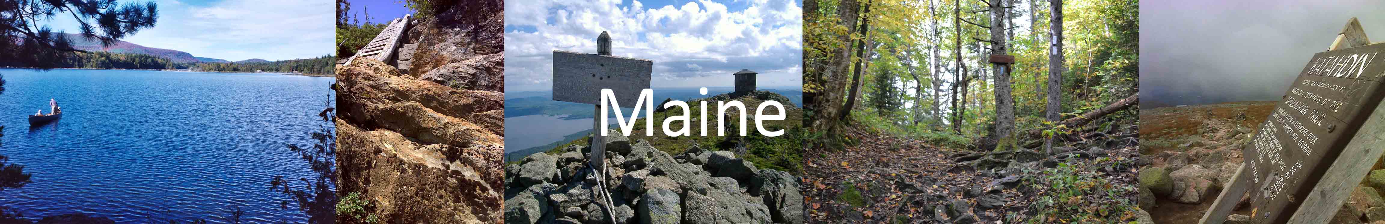
This is the last road crossing in Maine. Going South.
Aside from road access for the AT. This is a great access point for the Eyebrow Loop hike west of here and Table Rock Loop Hike east of here. Both offer spectacular views of Grafton Notch. 6/26/2006
|
20
Parking is on the left side of the road going northbound. There is a voluntary two dollar fee to park here.
|
|
askus3 @ optonline.net
|
|
There is a 10 foot high AT wooden insignia at crossing of Route 26. It is directly past the large parking lot. Lot is on left side going North and insignia is on right. There are permanent bathrooms in lot. There is a request for voluntary fee by kiosk.
|
8/1/19
|
20
|
|
ATEditors @ rohland.org
|
|
|
This is an orange-blazed trail that leaves the AT 0.1 mile south of Maine Highway 26 in Grafton Notch. 09/13/11
|
|
|
AT @ rohland.org
|
|
To the Speck Pond Trailhead (from Berlin): On NH 16, just south of Berlin, cross the Androscoggin River on the Cleveland Bridge (Unity Street), keep left passing through traffic signals at 0.7 mile. The road bears right and at 0.8 mile cross RR tracks and becomes Hutchins Street. The road turns sharply left at 1.6 miles and passes the James River mill yard. Watch for logging trucks. At 1.9 miles from NH 16, the wide gravel road on the right is Success Pond Road. Take care in following the road as it is a major access for logging in the area. At 12.3 miles from Hutchins Street, turn NE on a spur .8 mile to the trailhead.
To the Speck Pond Trailhead (from ME 26): It is 8.7 miles south. Then turn NE on a spur .8 mile to the trailhead.
|
From the small parking area the Speck Pond Trail follows the brook for 1.4 miles. Then it climbs more steeply to the Joe May Cut-off Trail at 3.1 miles and reaches the AT 3.6 miles from the trailhead on the north side of Speck Pond. 6/26/2006
|
6
All access points south of Grafton Notch (excluding Wright Trail) are trail access from the west approached by using the Success Pond lumber road. The directions will be the same but mileages will be different. The lumber road is rough and conditions vary from season to season. Take it slow.
|
|
askus3 @ optonline.net
|
|
|
Update (8/08) I saw little evidence of the mill yard mentioned above, but the directions from Berlin are otherwise accurate. AT the intersection with Success Pond Road and Hutchins St., there is a large sign reading : ORV Parking 1 mile with an arrow pointing down what is Success Pond Road. At this point the road is otherwise unsigned. There is a Success Pond Road sign at the next intersection. 08/26/08
|
|
|
David Cullen
|
|
At 10.9 miles from where the lumber road begins off Hutchins Street, (see directions to this point in previous 38.3 - Speck Pond MM) turn NE (right) on a branch road .6 mile to a junction. Make another right over a bridge (no sign) to the trailhead shortly beyond.
To the Mahoosuc Notch Trailhead (from ME 26): It is 10 miles south. Then turn NE (left) on a spur .6 mile to a junction. Make another right over a bridge (no sign) to the trailhead shortly beyond.
|
From the small parking area the Mahoosuc Notch Trail begins at a sign and climbs gradually for 1.9 miles to the west end of Mahoosuc Notch and ends at the AT. I went from ME 26 to this access point for one strenuous, scenic and most interesting dayhike. And of course this hike includes the infamous Mahoosuc Notch, usually considered the toughest mile on the Appalachian Trail. 6/26/2006
|
6
|
|
askus3 @ optonline.net
|
|
|
The Google map position is approximately where the AT crosses. 2/15/08
|
|
|
at @ rohland.org
|
|
Sunday River Road provides access to the Wright Trail. This is the only approach to the Mahoosucs from the east. Three miles north of Bethel, make a left off of US 2. Follow Sunday River Road 7.7 miles to a junction with twin bridges. Cross the bridges, turn right, and follow the dirt road (may be gated) 1.5 miles to the crossing of Goose Eye Brook. Trail parking is 200 yards ahead on the left.
|
The Wright Trail starts on a branch of Sunday River Road. Follow the valley of Goose Eye Brook meeting the AT in 4 miles. At 1.5 miles there is a junction with a south fork of this trail which intersects the AT 0.2 mile further south. The two forks combined with a .2 mile stretch of the AT make a nice 8 mile circular dayhike. 5/4/2006
|
I have not accessed the AT from Sunday River and used information on ME AT Map#7 (2004 edition) for filling in the chart for this access point.
|
|
askus3 @ optonline.net
|
|
At 8.0 miles from the turnoff onto the Success Pond lumber road from Hutchins Street, (see directions to this point in previous 38.3 - Speck Pond MM) the trailhead is on the right.
To the Goose Eye Trailhead (from ME 26): It is 13 miles south. The trailhead is on the left when approaching this way.
|
Now hiking, stay to the left at a fork with the Carlo Col Trail. Cross two streams and begin climbing steeply passing the ME-NH border at 1.4 miles. Traverse the main West Peak of Goose Eye at 2.9 miles and reach the AT at 3.0 miles.
This access is fantastic for making a Goose Eye Loop from the Success Pond lumber road. 6/26/2006
|
6
|
|
askus3 @ optonline.net
|
|
|
2/15/08
|
|
|
at @ rohland.org
|
|
|
Update: (8/08) There is currently a paper sign at the trailhead indicating the Carlo Col Trail. At the intersection with the Goose Eye Trail, there is a small sign for the Carlo Col Trail pointing up the logging road. A somewhat larger (but easily missed) sign indicates the Goose Eye Trail going to the left. Parking is roadside either at the Success Pond Road junction or further up the road which the Carlo Col Trail follows. That road is passable for at least 0.1-0.2 miles by passenger car or at least it was when I was there. I only checked out the trailhead and did not hike the trail. 08/26/08
|
Roadside parking
|
|
David Cullen
|
|
At 8.0 miles from the turnoff onto the Success Pond lumber road from Hutchins Street, (see directions to this point in previous 38.3 - Speck Pond MM) the trailhead is on the right.
To the Carlo Col Trailhead (from ME 26): It is 13 miles south. The trailhead is on the left when approaching this way.
These are the same directions as the Goose Eye Trail (46.0 MM) as both Goose Eye and Carlo Col Trails start here but diverge in 100 yards.
|
The Carlo Col trail starts as a logging road and passes the Goose Eye Trail Junction about 100 yards from the Success Pond Road. The trail follows old logging roads for 0.8 mile, crosses a brook and follows the valley for another 0.3 mile. Climb more steeply away from the brook and reach Carlo Col Shelter at 2.3 miles and the AT at 2.6 miles. The whole Carlo-Goose Eye Loop is 8.4 miles and offers some spectacular above treeline alpine scenery. The hike is strenuous. 6/26/2006
|
6
|
|
askus3 @ optonline.net
|
|
|
2/16/08
|
|
|
at @ rohland.org
|
|
|
Update: (8/08) There is currently a paper sign at the trailhead indicating the Carlo Col Trail. At the intersection with the Goose Eye Trail, there is a small sign for the Carlo Col Trail pointing up the logging road. A somewhat larger (but easily missed) sign indicates the Goose Eye Trail going to the left. Parking is roadside either at the Success Pond Road junction or further up the road which the Carlo Col Trail follows. That road is passable for at least 0.1-0.2 miles by passenger car or at least it was when I was there. I only checked out the trailhead and did not hike the trail. 08/26/08
|
Roadside parking
|
|
David Cullen
|
|
At 5.4 miles from Hutchins Street and the right turn on the Success Pond lumber road, (see directions to this point in previous 38.3 - Speck Pond MM) the spur road to the trailhead is on the right. The sign for the trail on Success Pond lumber road is gone! Make the right turn on the spur road .4 mile after the yellow tag - milemarker 5. Go up the spur road and you will then see AMC trail signs.
To the Success Trailhead (from ME 26): It is close to 16 miles south. The trailhead is on the left when approaching this way. Take the spur road on the left 0.6 mile beyond the yellow tag - milemarker 6.
|
To complete following the AT through Maine, you have to continue south along the AT 1.3 miles into New Hampshire. To get to this point in New Hampshire on the AT: from Success Pond Road, take the Success Trail 3 miles. The lower part of this trail must be followed with care through logged areas. When ascending at 1.6 miles, a looppath 0.3 mile long diverges right to a spectacular ledge outlook with fine views of the Presidentials. In a little more than 100 yards the loop trail rejoins the main trail (Success Trail). After a final short steep ascent you come to the AT along the main ridgecrest.
I hiked from the Jct of the Notch Trail to the Success Trail as one day hike which includes 7.7 miles along the AT. I also climbed the Goose Eye spur .2 mile round trip to the highest summit, West Peak. The total distance of this hike with trail access is 12.3 miles. The car shuttle is 5.5 miles along dusty & gravelly Success Pond Road, Remeber this road is a logging road and logging trucks have the right-of-way. Also, look out for moose along the road, especially from dusk to dawn. 6/26/06
|
4
|
|
askus3 @ optonline.net
|
|
|
On May 9th I took Success Pond Rd. to the Success Trail parking lot. It was 5.4 miles on rough logging Rd., but access spur Rd. to traihead was ok. Still 2-3' of snow approx. one mile from summit of Success Mtn./A.T. via Success trail. Headed so. on A.T. to Dream Lake, deep snow and over 25 large blowdowns making it a difficult trek. 05/22/13
|
one
|
|
kingpete @ safe-mail.net
|